
This is one in a series of five walks, by Wootton Bridge Parish Council, designed to help you explore some of Wootton Bridge’s history and beautiful surroundings.
Distance: Approximately 4 miles
Timing: 2½ hours
Start and finish: Outside The Sloop Inn, Mill Square
Outside the Sloop Inn, begin initially by taking the Coastal Footpath also signposted N190 New Road. After a few steps bear around to the right and follow the gravel road until you reach the metal gate.
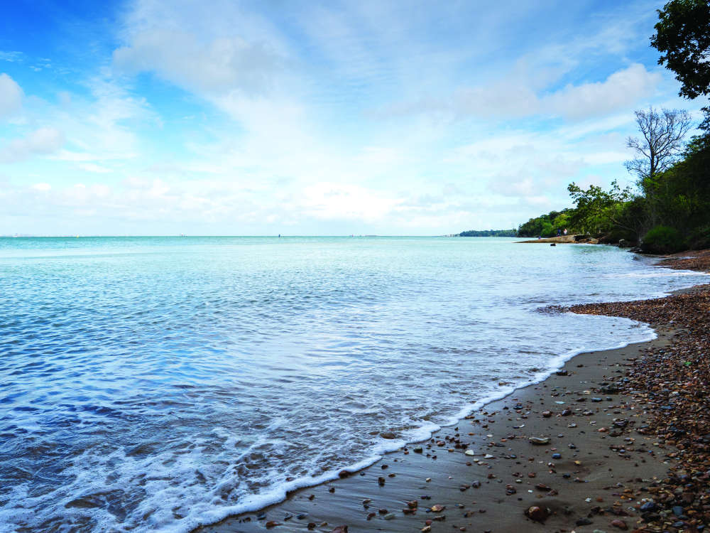
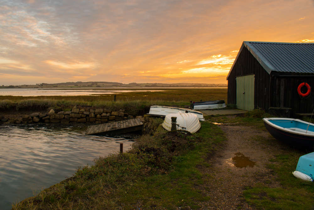
Pass through the gate into the green, with the dinghy park on the right. Cross the green with Southern Water pumping house on the left. Pause and enjoy the view down towards the Solent, which is part of a Site of Special Scientific Interest by reason of its special fauna, flora and geological features.
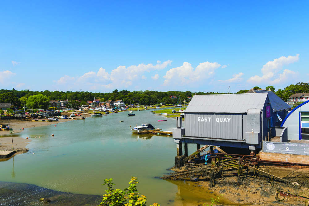
Walk past the pumping station (on your left) and continue on round into Pump Lane and emerge onto New Road. Turn right and follow the road, keeping the Creek to your right.
Some stunning views of the Creek are obtained on this section. Pass the houseboats, Creek Gardens. Continue on until you reach the crossroads at the end of New Road.
The path to the shore is signposted N156 but if you wish to take a short diversion to have another look at the Creek, turn right into Woodside Road, passing Woodside Hall Nursing Home on the left. At the end of the road you will come to footpath N216 that at low tide gives you access to the shore.
The north shore on both sides of the Creek is of particular beauty and has Area of Outstanding Natural Beauty designation. You will see the Wightlink Fishbourne terminal on the opposite bank. Retrace your steps back to the crossroads.
At the crossroads, footpath N156 takes you down to Woodside Bay and the beach. Depending on the tide it is possible to walk along the beach and walk up the path to join the Lower Woodside Road.
Beside footpath (N156) is the site of the former Warner’s Holiday Camp. This was once the site of Woodside House which later became a nudist colony that was eventually absorbed into Warner’s Holiday Camp. The old house was demolished. An amusing depiction of this is included in the Millennium Wall Hanging in the Community Centre, Brannon Way, showing two boys standing on their bike saddles peering over the fence!
An alternative route to the beach is to take the second road to the left, Lower Woodside Road, which follows the southern boundary hedge of the former Warner’s Holiday Camp. The woodland to your right is all part of an Area of Outstanding Natural Beauty and it is worth looking out for red squirrels along this part of the walk.
Keep going until you reach footpath N206 on the right hand side. Walk down the footpath and onto the beach where you will obtain further views of the shoreline and Solent.
Woodside Bay needs a special mention, as it is a highly important area, which has ‘SPA’ and ‘RAMSAR’ designations. The SPA means a ‘Special Protection Area’ of wetland of international Importance classified under the EU ‘Birds Directive’ to conserve the habitats of rare and migratory wild birds.
The ‘RAMSAR’ is a site identified by the signatory states to the International Convention at RAMSAR, Iran, in 1971 for the protection of internationally important wetlands and wildfowl habitats. So it may be worth having a look through your binoculars to look for the birdlife, particularly at low tide.
You will also be able to see the many ships and yachts, which pass up and down the Solent. When you are ready, return to Lower Woodside Road (immediate right hand turn if you come up from N156) and follow the lane which eventually rises and bears round to the left near a woodland named Wallishill Copse, which is on your right.
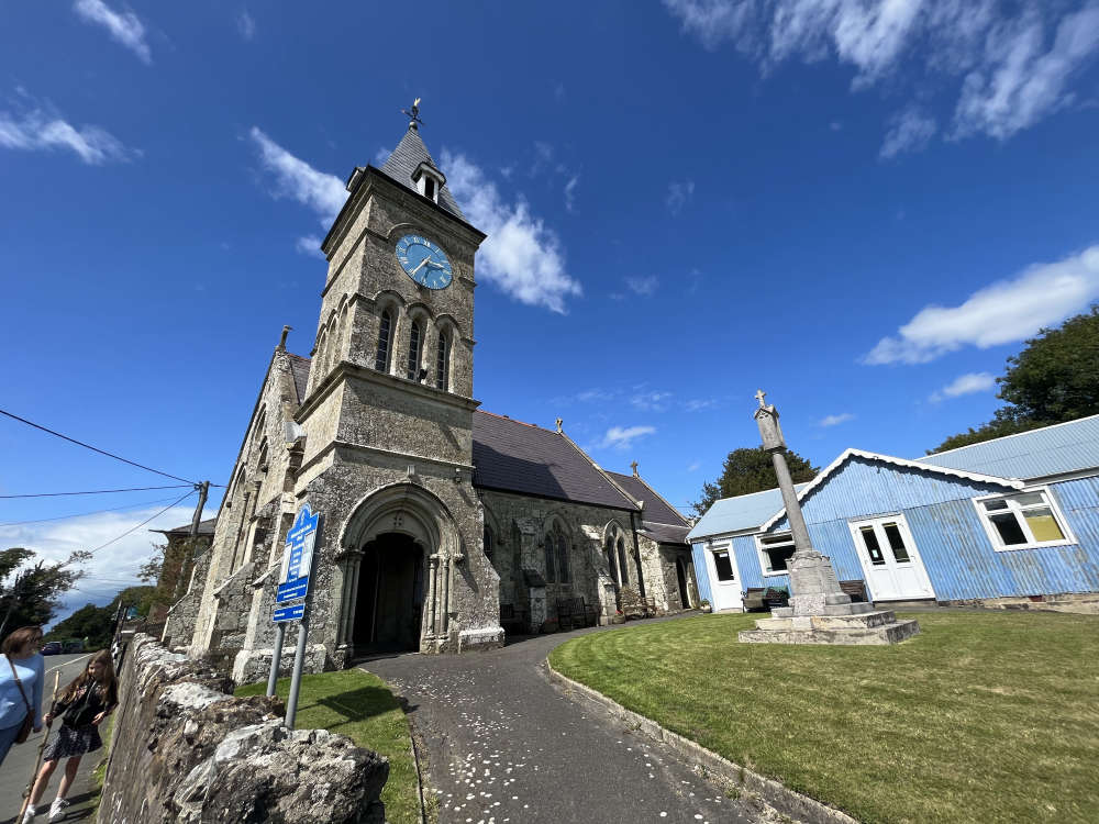
Continue up to the T-junction. At this point stop and enjoy the view across the Solent to Lee-on-the- Solent and Portsmouth to the east, and Southampton Water to the west. You can also see the towers of Osborne House to the west, from this viewpoint. If you are lucky you may see a cruise ship such as Queen Mary 2 passing through the Solent. Turn left by the telephone masts and then take footpath N99 to the right. Continue along this path until reaching St Edmund’s Church.
Turn left past the church and bear round to the right into Church Road. Walk along a couple of hundred yards and turn right into Footways. After a few steps turn left to gain access to the recreation ground and the Doorstep Green. Follow the designated pathway and exit by turning left onto the High Street. Proceed downhill and do look in the front garden of No. 80 High Street. On view is the Queen Victoria Jubilee fountain, originally erected in 1887 (further down the High Street). It was Wootton’s first piped water supply. The bottom of the hill brings you to journey’s end at The Sloop Inn.
Acknowledgements:
Wootton Parish Council wishes to thank the many people and volunteers who have supported and helped in whatever way with the production of the Walks About Wootton Project.
Illustrations by Coco Design co.
 February Fiction to Enjoy this Month
 The Wizard of Oz a 'Visual Feast'
 Four Books to Tuck in to This New Year
 "Fabulous, Funny and Festive": Snow White Arrives at Mayflower Theatre
 Walking with Nordic Poles
 Chaotic Fun at This Year's Pompey Panto
 An Interview with Southampton Panto Star Christopher Biggins
 All Aboard as The Kings Theatre Portsmouth Launches 2023 Panto
 October Puzzle Solutions
 Walking the Isle of Wight: Wroxall Woodland
 Four Books to Read on the Beach
 Interview: The Drifters Girl Arrives in Southampton
 Just the ‘Golden’ Ticket: Charlie and the Chocolate Factory Arrives in Southampton
 Step Back into Cowes Past at 'School Days' Exhibition
 Walking the Island: Newtown Creek
 Five Early Summer Reads to Enjoy in the Sunshine
 Walking the Isle of Wight: Queen Victoria’s Town Trail
 Book Reviews: From the Page to the Mind
 Walking the Island: Seaview to Appley
Comments
Add a comment